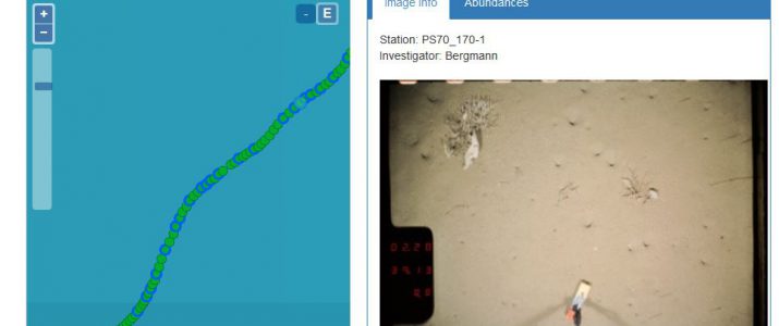
The brand new “OFOS-Viewer” (Ocean Floor Observation System) combines map and seabed image gallery in a user-friendly web tool. Images, geo positions and meta information from several stations and campaigns can be aggregated and visualized. The tool is currently available at www.awi.de: Select a station and go!